Australia is widely known to have an extensive fire season during Summer. However, in recent years it is common that the fire season extends to Autumn or even Winter each year. In fact, a recent study suggests that the burned area during this season has increased exponentially in the last thirty years. Furthermore, the study links the overall increase in burned areas of Australian forests to climate change.
In the year 2021, the area of West Australia, in the vicinity of the city of Perth, was affected by a heavy fire season that extended all the way to December and the beginning of January. In the first days of December 2021, a huge fire raged close to Margaret River. The fires went on for the rest of December 2021 in this area and all this is registered in satellite imagery publicly available.
Climate change is a global phenomenon, and it is expected that the trend we see in Australia will follow on a bigger scale for areas prone to forest fires. For this reason, there is a need for an improved, precise and scalable way to assess the area lost to forest fires on-demand and on a global scale. My goal in this post was to assess the extent of the forest fires in a study area around the city of Perth, West Australia, starting from August 2021 and ending in March 2022, using the pipeline we have designed for this task here in EDEO.
Study area
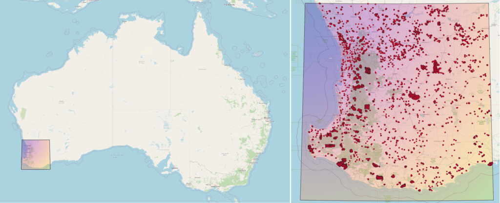
Below I show the study area I worked with to study forest fires that happened in Southwest Australia, in a region comprising the city of Perth, Margaret River and several State Forests. Also shown are red points corresponding to VIIRS fire alerts from 2021-08-01 to 2021-03-31. According to these points, we can see that a couple of big fires happened in the southwest area of the study region and also that it seems that some of the fires extend up from this corner through the green area along the east coast. This area includes several national forests like the Jarrahwood, Blackwood, Mumballup and Dwellingup National Forests, among others.
To get an idea of how heavy this fire season has been, I decided to plot the high confidence VIIRS fire alerts by day from December of 2018 to the end of March of 2022:
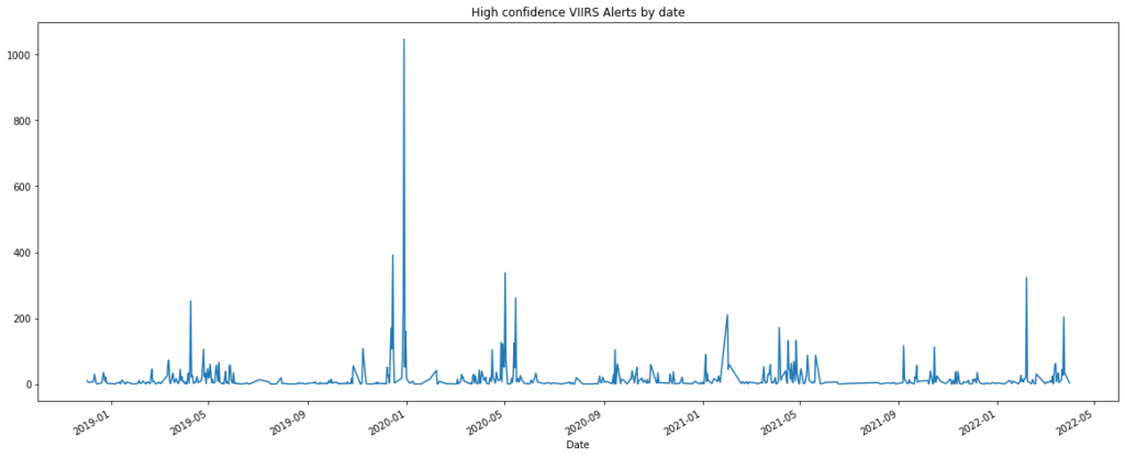
Clearly, this fire season is not as intense as that one from the Black Summer, which occurred two years ago, from August 2019 to April-May 2020. However, it looks still more intense than the one from one year ago. Following this, I decided to look at the aggregated number of points from the August-March seasons of the three different years to get a better feeling for the intensity of this year’s fire season:
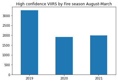
So, the fires within the study area for the dates between the 1st of August 2021 and the 31st of March 2022 seem to be a little more intense, in terms of the number of fire alerts, than the one from one year ago in the same area and dates. And a little more than half as intense as the one from 2019.
Following the fires
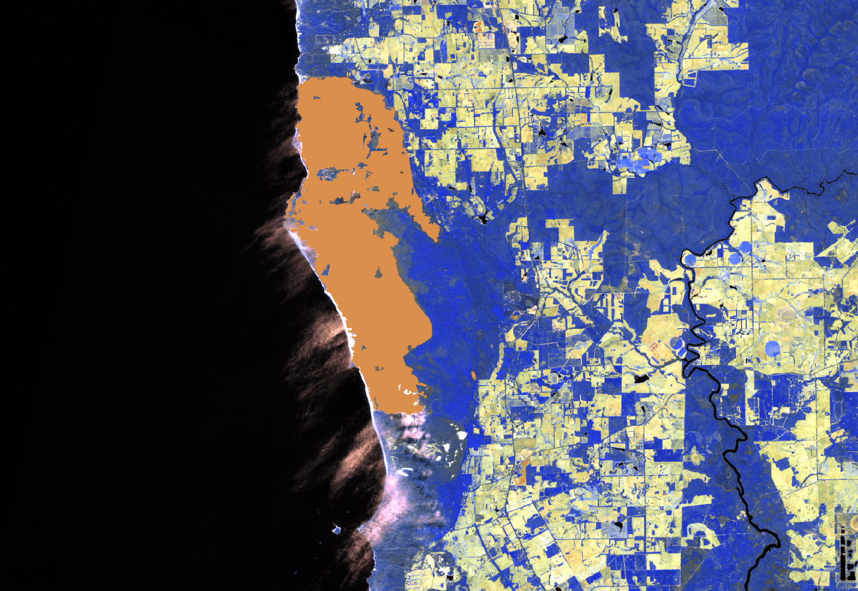
Below we can see a false-color image from a satellite meant to allow easier identification of fire scars. This image corresponds to a beach in Hamelin Bay, south of Margaret River, taken on March 2022. Here it is possible to see a big fire scar mapped by the trained classifier. According to this classification, the fire raged from the 8th of December until the 28th of December of 2021. This particular fire made it to the headlines of several newspapers due to its intensity, extension and closeness to important populated areas.

Now we can zoom a little bit and take a look at how that place was before and after the fire raged. Two natural-color satellite images are shown below. The one at the left of the slider corresponds to November 2021, the one on the right is from the end of December 2021. The estimated burned area is more than 5000 hectares.


This types of analysis are very easy to achieve using the EDEO BlazeMap™. You can see the corresponding BlazeMap™ for the study area around Perth for the fire season between 1st August 2021 and 31st March 2022 and explore the spatiotemporal extent of the fires with ease.