EDEO Project Portfolio
Explore a curated showcase of our most innovative and impactful projects (arranged chronologically)
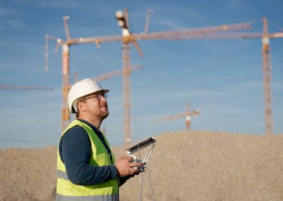
Successful Completion and New Beginnings at Munich’s “Bildungscampus”
We're thrilled to announce the successful completion of our four-year drone monitoring project for Munich's Bildungscampus, including a sports park....
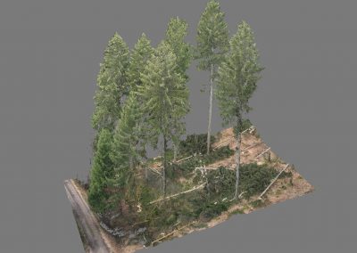
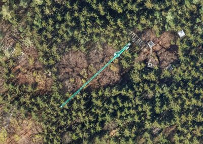
Enhancing Forestry Research with High-Precision Drone Imaging
In this cutting-edge project, we collected reference data for a smart-chainsaw research and development initiative using drone technology. This involved...
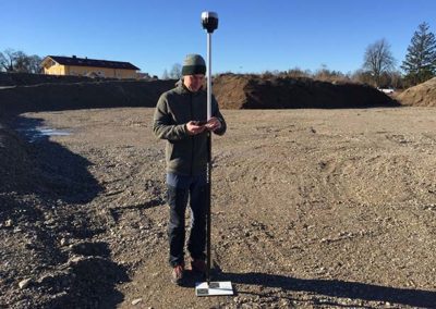
Sewer Network Mapping
We utilized modern methods for sewage channel infrastructure mapping, which is a rapidly evolving field in urban planning. Our task...
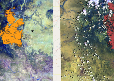
BlazeMap™: 2022 New Mexico Wildfires
Focusing on the prescribed burns in New Mexico, USA, which later escalated into major wildfires. We used our BlazeMap™ technology...
BlazeMap™: Tracking Western Australia’s Wildfires
Analysis of the extended fire season in Western Australia, particularly around Perth and Margaret River. This project utilized the EDEO...
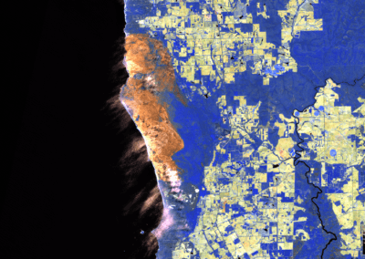
Wildfire Analysis in Argentina’s Corrientes and Iberá
We focused on the intense fire activity in Argentina's Corrientes province and Iberá National Park. Using the EDEO BlazeMap™ pipeline...
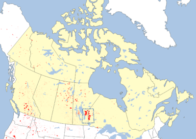
High-Accuracy Wildfire Mapping in Canada
We mapped the wildfire-burned areas east of Lake Winnipeg in Canada. This extensive study covered over one million hectares and...
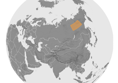
Siberia Wildfire Mapping (High-Res Large-Scale Mapping)
In this study we focused on a vast area in Siberia and meticulously mapped the burn patterns in the Sakha...
Multi-Seasonal Aerial Photogrammetric Mapping of Tree Species Composition
For the Technical University of Munich, we conducted a detailed study in a Bavarian forest near Freising, using six ultralight...
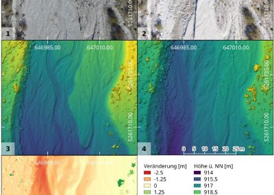
Analyzing Hydromorphological Shifts in the Bavarian Alps
EDEO GmbH conducted a comprehensive study of the Friedergries area in the Bavarian Alps. Using UAV data and historical aerial...
Aerial Photogrammetric Mapping of Osterseen Lakes
In a collaborative project with the Technical University of Munich's Limnological Research Station, we conducted a multi-seasonal ultralight remote sensing...
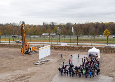
Drone Monitoring of Munich’s Bildungscampus: A Four-Year Construction Journey
We have been awarded the contract for a significant construction project: the development of the Bildungscampus in München Riem, inclusive...
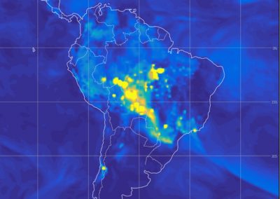
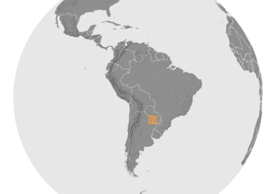
Pantanal Wildfires Analysis: Mapping Burn Severity for EIIW
For the European Institute for International Economic Relations under Prof. Welfens, we undertook a project focusing on the extensive fires...
![WiRiANet [aka EDEO BlazeMap™] Project Funded](https://www.edeo-gmbh.de/wp-content/uploads/2024/02/Screenshot_2020-06-17_16-49-21-400x284.png)
WiRiANet [aka EDEO BlazeMap™] Project Funded
With funding now secured through the BayTOU program by Bayern Innovativ and sponsorship from the Bavarian Ministry of Economic Affairs,...
Aerial Photogrammetric Mapping of Alpine Forests
In this project for the Technical University of Munich, where we conducted an ultralight (UL) flight over the German Alps...