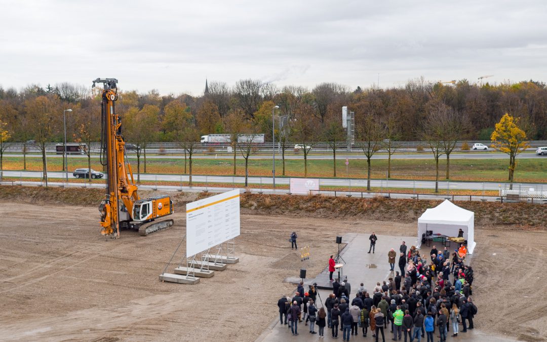
Drone Monitoring of Munich’s Bildungscampus: A Four-Year Construction Journey
Drone Monitoring of Munich's Bildungscampus: A Four-Year Construction Journey In a major development for our company, we have been awarded the contract for a significant construction project: the development of the Bildungscampus in München Riem, inclusive of a sports...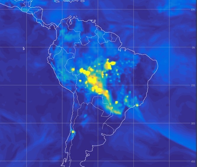
Pantanal Wildfires Analysis: Mapping Burn Severity for EIIW
Pantanal Wildfires Analysis: Mapping Burn Severity for EIIW For the European Institute for International Economic Relations under Prof. Welfens, we undertook a project focusing on the extensive fires in the Pantanal region, spanning Brazil, Bolivia, and Paraguay. We...![WiRiANet [aka EDEO BlazeMap™] Project Funded](https://www.edeo-gmbh.de/wp-content/uploads/2024/02/Screenshot_2020-06-17_16-49-21-1080x675.png)
WiRiANet [aka EDEO BlazeMap™] Project Funded
WiRiANet [aka EDEO BlazeMap™] Project Funded With funding now secured through the BayTOU program by Bayern Innovativ and sponsorship from the Bavarian Ministry of Economic Affairs, Regional Development and Energy, we are set to commence a groundbreaking project. This...